Drone Mapping Central Florida is transforming the construction industry by providing faster, safer, and more accurate site information than traditional surveying methods. Contractors, developers, engineers, and project managers are increasingly using drone mapping to improve planning, monitor progress, reduce costs, and complete projects more efficiently.
At TrueSite360, we provide professional Drone Mapping services throughout Central Florida using advanced UAV technology, photogrammetry, and reality capture software. Our high-resolution maps and 3D models help construction teams make informed decisions while reducing delays and costly mistakes.
What Is Drone Mapping?
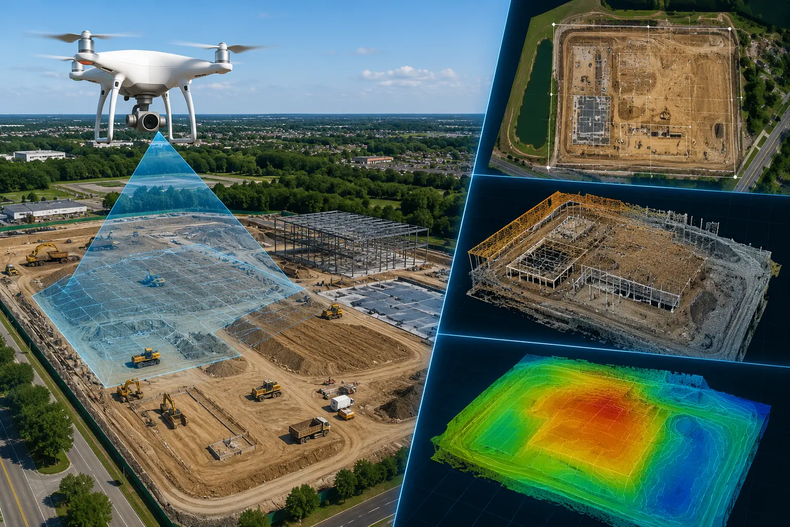
Drone Mapping Central Florida uses unmanned aerial vehicles (UAVs) equipped with high-resolution cameras and GPS technology to capture thousands of overlapping images of a construction site. Specialized software processes these images into highly accurate products such as:
- Orthomosaic maps
- Topographic surveys
- 3D site models
- Digital surface models
- Elevation maps
- Progress documentation
These deliverables provide construction teams with precise, up-to-date information that supports every stage of a project.
Faster Site Surveys
Traditional land surveys often require multiple workers, specialized equipment, and several days to complete. Drone mapping can capture hundreds of acres in just a few hours.
This allows contractors to begin planning sooner while reducing delays caused by waiting for survey data. Faster data collection also means project managers receive current information whenever it is needed throughout construction.
Reduce Construction Costs
One of the biggest advantages of Drone Mapping Central Florida is cost savings.
Drone mapping helps reduce expenses by:
- Eliminating repeated manual surveys
- Reducing labor costs
- Minimizing equipment rentals
- Detecting problems before they become expensive
- Improving project coordination
- Reducing costly rework
Early identification of grading issues, drainage concerns, or design conflicts can save thousands of dollars over the life of a project.
Improve Project Planning
Accurate site information is essential before construction begins. Drone mapping provides detailed measurements, terrain models, and existing site conditions that allow engineers and contractors to plan with confidence.
Project teams can:
- Verify property boundaries
- Analyze terrain
- Plan drainage
- Calculate earthwork quantities
- Identify access routes
- Improve site logistics
Better planning leads to smoother construction and fewer unexpected surprises.
Monitor Construction Progress
Construction projects change every day. Drone mapping provides an efficient way to document progress throughout the project lifecycle.
Regular aerial surveys allow stakeholders to:
- Compare progress against schedules
- Verify completed work
- Monitor subcontractor performance
- Identify delays early
- Produce visual reports for clients and investors
Having an accurate visual record helps improve communication between owners, contractors, architects, and engineers.
Increase Job Site Safety
Traditional surveying and inspections often require workers to enter hazardous environments or climb onto unfinished structures.
Drone mapping dramatically reduces these risks by capturing detailed aerial data remotely.
Benefits include:
- Fewer workers exposed to hazards
- Reduced need for scaffolding
- Less time working near heavy equipment
- Safer inspections of difficult-to-access areas
Improving safety also reduces potential liability and project interruptions.
Better Earthwork and Volume Calculations
Accurate earthwork calculations are critical for budgeting and scheduling.
Drone mapping allows contractors to quickly calculate:
- Stockpile volumes
- Cut-and-fill quantities
- Excavation progress
- Material inventory
- Site elevations
Because calculations are generated from highly accurate aerial data, project teams gain better control over material management and equipment utilization.
Who Benefits from Drone Mapping?
Drone Mapping is valuable for many industries throughout Central Florida, including:
- Commercial Construction
- Civil Engineering
- Land Development
- Municipal Projects
- Road Construction
- Industrial Facilities
- Utility Companies
- Mining Operations
- Real Estate Development
- Infrastructure Projects
Whether managing a small commercial site or a large infrastructure project, drone mapping provides accurate information that improves decision-making.
Why Choose TrueSite360?
TrueSite360 provides professional Drone Mapping Central Florida services using industry-leading drone technology and advanced mapping software. Our experienced team delivers accurate maps, 3D models, topographic surveys, and construction documentation that help clients reduce costs, improve efficiency, and keep projects on schedule.
We proudly serve contractors, developers, engineers, municipalities, and commercial property owners throughout Central Florida with reliable aerial mapping solutions.
Frequently Asked Questions
How accurate is drone mapping?
Professional drone mapping can achieve survey-grade accuracy when proper ground control and processing methods are used.
Is drone mapping faster than traditional surveying?
Yes. Drone mapping can capture large construction sites in just a few hours, significantly reducing field time.
Can drone mapping calculate stockpile volumes?
Absolutely. Drone mapping provides accurate volumetric calculations for stockpiles, excavation, and earthmoving operations.
How often should a construction site be mapped?
Many projects benefit from weekly or monthly drone flights to monitor progress and document construction milestones.
Does TrueSite360 provide Drone Mapping throughout Central Florida?
Yes. TrueSite360 offers professional Drone Mapping Central Florida services for commercial, industrial, engineering, and construction projects across the region.
Ready to Improve Your Construction Project?
If you’re looking for a faster, safer, and more cost-effective way to survey, monitor, and manage your construction site, TrueSite360 can help. Our Drone Mapping Central Florida services deliver accurate aerial data that improves planning, reduces costs, and keeps projects moving forward.
Contact TrueSite360 today to learn how our drone mapping solutions can help your next construction project succeed.