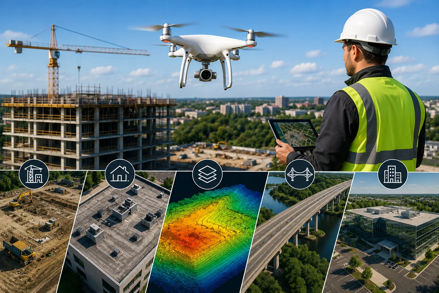
Choosing the right drone service can make a significant difference in the success of your project. Whether you’re managing a commercial construction site, inspecting infrastructure, developing property, or maintaining industrial assets, selecting the right aerial solution ensures you receive accurate data that supports better decisions while saving time and money.
At TrueSite360, we provide professional Drone Services Central Florida for commercial, industrial, engineering, construction, and municipal projects. From aerial imaging and inspections to surveying, mapping, reality capture, and digital twins, our team helps clients choose the right solution for their unique needs.
In this guide, we’ll explain the most common drone services and help you determine which one is right for your next project.
Why Drone Services Are Growing
Drone technology has rapidly become an essential tool across many industries because it delivers accurate information faster, safer, and more affordably than many traditional methods.
Professional drone services help organizations:
- Reduce project costs
- Improve safety
- Increase productivity
- Document project progress
- Improve communication
- Support better planning
- Reduce costly rework
Instead of relying on outdated drawings or time-consuming manual inspections, organizations now have access to current aerial data whenever they need it.
Aerial Imaging
If your goal is to capture high-quality photographs or video of a property, Aerial Imaging is the ideal solution.
Aerial imaging is commonly used for:
- Commercial real estate
- Property marketing
- Construction progress
- Insurance documentation
- Facility management
- Roof inspections
- Promotional videos
High-resolution aerial photography provides a complete view of your property while creating professional visual documentation that can be used for reports, marketing, and planning.
Best for: Property owners, developers, real estate professionals, and facility managers.
Drone Inspections
Drone inspections provide a safer alternative to traditional building inspections.
Instead of climbing ladders or renting expensive lifts, drones capture detailed imagery of difficult-to-access areas.
Common inspection projects include:
- Roof inspections
- Building exteriors
- Bridges
- Towers
- Utilities
- Solar farms
- Industrial facilities
- Construction sites
Drone inspections reduce safety risks while providing detailed visual records that support maintenance and repairs.
Best for: Commercial property owners, municipalities, engineers, and industrial facilities.
Surveying & Mapping
Surveying and mapping services provide accurate measurements that support engineering and construction projects.
Deliverables may include:
- Topographic maps
- Orthomosaic maps
- Site measurements
- Elevation models
- GPS data
- Terrain analysis
Accurate mapping improves planning while reducing field work and project delays.
Best for: Engineers, contractors, developers, municipalities, and land survey professionals.
Reality Capture & Digital Twins
Reality Capture creates highly accurate digital representations of buildings, infrastructure, and construction projects.
These services include:
- 3D Models
- Digital Twins
- Point Clouds
- Existing Conditions Documentation
- Virtual Site Records
Digital Twins allow building owners and project teams to inspect and manage assets without always returning to the field.
Best for: Architects, engineers, commercial property owners, and facility managers.
Volumetric Measurements
Construction companies, mining operations, and material suppliers often need accurate volume calculations.
Drone volumetric surveys measure:
- Stockpiles
- Excavation
- Earthwork
- Aggregate piles
- Fill quantities
- Material inventory
Accurate measurements improve project planning while reducing estimation errors.
Best for: Construction companies, mining operations, aggregate suppliers, and earthmoving contractors.
Drone Consulting
Organizations looking to integrate drone technology into their operations often benefit from professional consulting services.
Consulting may include:
- Technology recommendations
- FAA guidance
- Workflow development
- Fleet planning
- Data management
- Operational procedures
- Training recommendations
An experienced consulting partner helps organizations maximize the return on their drone investment.
Best for: Businesses building or expanding internal drone programs.
How to Choose the Right Drone Service
Before selecting a drone service, ask yourself several important questions.
What information do I need?
If you simply need photographs, aerial imaging may be sufficient.
If you need measurements, surveying or photogrammetry is usually the better solution.
Will I need accurate measurements?
Engineering, construction, and land development projects often require survey-grade mapping instead of standard aerial photography.
How often will data be collected?
Construction projects may require weekly or monthly flights to monitor progress, while commercial property inspections may only need annual documentation.
What deliverables are required?
Different projects require different outputs, including:
- Photos
- Videos
- Orthomosaic maps
- 3D models
- Point clouds
- Digital Twins
- Inspection reports
- Volume calculations
Working with an experienced drone provider ensures you receive the right deliverables for your project goals.
Why Choose TrueSite360?
TrueSite360 provides comprehensive Drone Services Central Florida using advanced UAV technology, FAA-certified pilots, and industry-leading processing software.
Our services include:
- Aerial Imaging
- Drone Inspections
- Surveying & Mapping
- Reality Capture
- Photogrammetry
- Digital Twins
- Volumetric Measurements
- Drone Consulting
We proudly serve contractors, developers, municipalities, engineers, commercial property owners, industrial facilities, and infrastructure organizations throughout Central Florida.
Whether your project requires detailed inspections, accurate mapping, or comprehensive digital documentation, our team delivers reliable aerial solutions designed to improve efficiency and reduce costs.
Frequently Asked Questions
What drone service is best for construction projects?
Construction projects often benefit from surveying, mapping, aerial imaging, construction progress monitoring, and volumetric measurements depending on project requirements.
Can one drone flight provide multiple deliverables?
Yes. A single flight can often produce aerial photographs, orthomosaic maps, 3D models, point clouds, and progress documentation, depending on the project objectives.
Are commercial drone services safe?
Yes. Professional drone operations are performed by FAA-certified pilots who follow strict safety procedures and applicable regulations.
How do I know which drone service I need?
The best solution depends on your project goals. A professional drone provider can recommend the right service based on whether you need imagery, measurements, inspections, or digital models.
Does TrueSite360 provide Drone Services throughout Central Florida?
Yes. TrueSite360 proudly provides Drone Services Central Florida for commercial, industrial, engineering, municipal, and construction projects throughout the region.
Ready to Find the Right Drone Solution?
Every project is different, and choosing the right drone service is the first step toward better results. Whether you need aerial photography, inspections, mapping, reality capture, or digital twins, TrueSite360 has the expertise and technology to deliver accurate, reliable data tailored to your needs.
Contact TrueSite360 today to discuss your project and discover how our professional Drone Services Central Florida can help you save time, reduce costs, and make more informed decisions.